%20(942%20x%20204%20px).jpg)
Hike to the Third Carbet Waterfall (Capesterre-Belle-Eau, Guadeloupe) - How to find it?
- corentindutal
- Feb 17
- 2 min read

Updated: Mar 11
GPS track of the hike to do the Third Carbet Waterfall without getting lost. This Waterfall, 20m high, is the smallest of the three Carbet Waterfalls but is nonetheless impressive thanks to its flow! Its access is free unlike the first Carbet Waterfall and the Second Carbet Waterfall and it is accessed from Capesterre, and not from the reception of the Carbet Waterfalls. Allow about 1 hour to reach the Waterfall on a rather accessible tropical forest path. The descent to the basin is rather steep and will be difficult for people with little experience. Its access has also been prohibited by the municipality for several years because of landslides .
This hike is part of our exclusive pack: 16 must-see trails in Guadeloupe. Enjoy it!
Photos of the Third Carbet Falls in Guadeloupe


How long ?
Allow approximately 2 to 2.5 hours for the round trip.
Difficulty
AVERAGE
What should be planned?
Good walking shoes A K-way
1.5L of water

Start of the hike
Hike to the Third Carbet Waterfall in Guadeloupe
The Third Carbet Falls is one of the three emblematic waterfalls of the Guadeloupe National Park. Lower than the first two (20 meters compared to 110 and 115 meters), it stands out for its wild and immersive setting. Located at an altitude of approximately 390 meters, it offers hikers a moment of freshness in the heart of lush vegetation.
Access and starting point
The starting point of the hike is located in Petit-Marquisat , in the commune of Capesterre-Belle-Eau. You must take the Grande Coulée forest road and park near the start of the marked trail. The trail is well-maintained but can be muddy after rain, making hiking shoes essential.
Hiking details
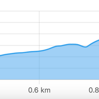
Distance : Just under 4 km round trip
Duration : 2h to 2h30 depending on the pace
Difficulty : Medium (slippery passages and rocks to cross)
The route begins with a crossing of humid forest where you can observe mahogany trees, tree ferns and balisiers. Quickly, you follow the Grand Carbet river, with several viewpoints on the surrounding reliefs.
Arrival at the waterfall
After about 1h15 of walking, the reward is at the end of the path: the Third Waterfall of Carbet is revealed in a basin with clear water, ideal for a refreshing swim, but still prohibited by the municipality due to landslides. The environment is preserved, far from the crowds of the First Two Waterfalls.
Practical advice
Check the weather before you set off: trails may be impassable after heavy rain.
Bring mosquito repellent and plenty of water.
Respect nature by not leaving any waste on site.
Download the GPX Track of the Hike
For those who wish to explore the Trace de la Troisième Chute du Carbet independently, we offer a detailed GPX track of the hike, to open on an application such as maps.me
This hike is part of our exclusive pack: 16 must-see trails in Guadeloupe. Enjoy it!


Comments